Technical Details
RHV Airport Information:AirNav
95 miles east of San Jose in the Sierra foothills is Columbia Airport (O22). The town of Columbia is an easy 10 minute walk away. Columbia dates back to the Gold Rush era and is a California State Park. Many of the buildings date back to the 1850s. For more about the living museum see here.
Flying into Columbia is fun too - for some of us flying is the most fun you can have with your clothes on, but I am biased. The simplest way from the Reid Hillview / San Jose area is to cross the Diablo Range over the Calaveras Reservoir, then pass Livermore (LVK) on your left.
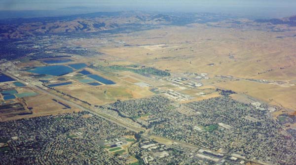
Livermore airport is smack in the centre of the picture above. After LVK, aim for the Manteca VOR (ECA). As you cross the wide Central Valley, you'll spot Tracy airport (TCY) on your right.
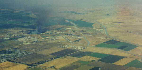
The Manteca VOR is less than five miles ESE from SCK. Columbia Airport is 37.7 miles out on the 055 radial from ECA. After Manteca the ground slowly changes from agriculture to pasture and starts rising. A low range of hills hides the huge Melones Reservoir from view until you are almost over it and begin to wonder about your navigation. Once you have spotted the reservoir it is time to check the AWOS and get organized for landing.
The field is 2118' high, but on warm days the density altitude can exceed 5000', so flatlanders beware and check your aircraft performance. The usable runway is just over 4000' long and most small planes will be able to land fine, though the ground speed will be higher than you may be used to. However on takeoff, there is unfriendly terrain in all directions, and the hills rise rapidly towards the East.
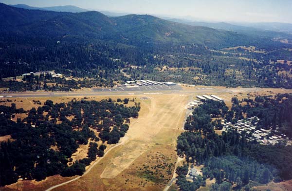
The paved runway is 17/35 and the winds typically favour runway 17 but there is usually a crosswind, and there can be turbulence on final approach. I haven't yet landed on 35, every time it has been 17. The pattern is to the West, 1000' AGL (3118' MSL), right traffic for 17 and left for 35. There is also a turf runway 11/29, 2600' long, looking pretty good.
Here's a picture from the right downwind for runway 17. The turf runway can be clearly seen, as can the rising terrain to the east. The terminal is the flat topped building just left of center with a lighter area of tarmac in front of it.
At nighttime there are frequently deer and other animals on the airfield, do take care. Meeting a deer at 50kts or more is unlikely to be a happy encounter for either of you.
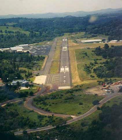
Here's a view of the approach end of runway 17.
Notice the light colored parking area to the left
of the diaplaced threshold. In the summer there are firefighting tankers
parked here and they have priority over you!
Once you land on 17, the terminal is to your left and transient parking is to the left of the terminal. The FBO, Bald Eagle Aviation, is in the terminal building. They'll refuel your plane if you give them a credit card imprint. They leave the receipt inside a chewing gum packet behind the doorhandle of the plane. (If you are heavy you may want to recheck your aircraft's performance and chose to put less than a full tank of gas in)
So now you have landed safely and are wondering what to do. Even if you only have half an hour, the town is worth a quick visit. After you have come out of the terminal exit, bear left toward a sign marked "Nature Trail".
Follow the trail through low shrubbery for about 5 minutes till you get to the road, and then another five minutes will have you at the "Columbia State Park" sign. A minute or two later you will reach the historic Fallon Hotel, dating back to 1857. If you don't have much time, do at least take the few minutes it takes to get off the main road into the town proper and walk up and down
If you have more than 10 minutes to spare to enjoy your visit, check out my What To Do In Columbia page.
When you are done, retrace your steps to the airport
and have a good flight home. Watch out for those animals and the tankers.
![]()